Market Analysis
Could AI and Satellite Data Have Helped Tennessee Farmers Navigate Flooding Devastation?
Tennessee’s agricultural sector is no stranger to the challenges posed by extreme weather, but the recent devastation caused by Hurricane Helene is an unfortunate reminder of how quickly conditions can change. By the end of September, Tennessee farmers had made significant progress in their harvest, with 70% of the state’s corn and 42% of its soybeans already gathered, according to the USDA's Crop Progress report.
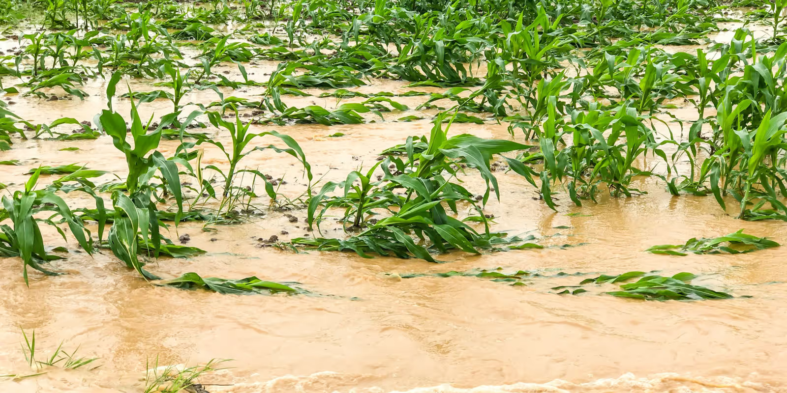
The situation took a sharp turn, however, when heavy rains associated with the hurricane led to unprecedented flooding, especially in East Tennessee, where farmers like John Litz saw large swathes of their crops destroyed in just a few hours.
Litz, who farms 3,000 acres of corn, soybeans, wheat, and turf grass across five counties, lost nearly 600 acres of soybeans and 50 acres of turf grass as floodwaters inundated his fields. His story is a poignant example of how quickly natural disasters can devastate agricultural operations. For Litz and many other farmers in Tennessee, the floodwaters not only wiped out crops but also left layers of silt across fields, further complicating the recovery process.
The loss for Tennessee’s farming community has been immense, but with the right tools and technology, could the outcome have been different?
In recent years, advancements in satellite data and artificial intelligence (AI) have offered a new way forward for farmers facing unpredictable weather conditions. Platforms like SatYield, which combine satellite imagery with AI-driven insights, provide an invaluable tool for farmers seeking to know the risks and potential crop losses of extreme weather events. In the case of Hurricane Helene’s impact on Tennessee, it’s worth exploring how such technologies could have made a difference.
Traditional Data vs. Real-Time Solutions
For decades, farmers have relied on government reports such as the USDA’s Crop Progress updates to track yield and harvest conditions. While these reports are generally accurate, they are based on surveys and historical data that can be weeks behind current conditions. This delay in information can leave farmers vulnerable, especially when weather events like floods, droughts, or hurricanes occur without sufficient warning.
Take the USDA’s corn yield forecast for 2024 as an example. With a record-setting prediction of 183.8 bushels per acre, the forecast painted an optimistic picture for U.S. agriculture. However, while these long-term projections are valuable, they don't account for sudden and unexpected events like the hurricane that hit Tennessee. Farmers like Litz, who rely on traditional reports, often face the reality of reacting to conditions rather than anticipating them.
In contrast, platforms like SatYield offer a different approach by providing ongoing, in-season insights into crop yields and production estimates. Using a constellation of satellites (Sentinel-1 and Sentinel-2 operated by ESA) and AI-powered prediction models, SatYield can track environmental and crop conditions across large areas, giving farmers the ability to see exactly what’s happening in their fields as it unfolds. This kind of data could have been instrumental in helping Tennessee’s farmers to be prepared to manage their harvests before the hurricane struck.
The Potential of SatYield’s Technology

SatYield’s Crop Yield Prediction designed to help farmers make informed, data-driven decisions by providing accurate yield forecasts and in-season crop monitoring of agricultural conditions. Unlike traditional reports that rely on manual surveys and delayed satellite data, SatYield’s technology processes data from multiple satellites, allowing it to monitor key variables like soil moisture, vegetation health, and local weather patterns in real time. This level of detail and speed could have been particularly useful in the days leading up to Hurricane Helene, giving farmers a clearer picture of which fields were at the greatest risk and allowing them to take proactive measures.
For example, Litz mentioned that his worst-affected fields were in river bottoms, areas that are naturally more susceptible to flooding. With technology such as SatYield and satellite imagery, he could assess the potential damage to his crops as a result of the flood and make a strategic decision about when and where to focus their resources.
Additionally, SatYield’s technology could have offered insights into the broader regional impacts of extreme weather events. Farmers across East Tennessee faced a variety of conditions, from drought-induced early maturity to sudden flooding. Satellite driven crop models could have synthesized this data to provide an accurate forecast of how these factors were likely to affect crop yields.
A More Resilient Future for Agriculture

Looking ahead, the adoption of technologies like SatYield could be a game changer for the agricultural industry. In a world where extreme weather events are becoming more frequent and more severe, the ability to get critical information driven by Satellite data and AI is no longer a luxury—it’s a necessity. For farmers like John Litz, who lost nearly half of his soybean crop in a matter of hours, having the right information at the right time could mean the difference between saving a harvest and losing it all.
As the agricultural sector faces growing challenges from climate change and unpredictable weather patterns, embracing these new technologies will be essential for building a more resilient and sustainable future.
SatYield’s mission to democratize access to high-quality agricultural data aligns with the needs of today’s farmers, helping them make data-driven decisions that reduce risk, increase yields, and ensure long-term sustainability. By harnessing the power of satellite data and AI, platforms like SatYield can help farmers weather the storms “literally”.
more from the blog
