Market Analysis
From Pixels to Insights: Unveiling New Source of Data Through Satellite Imagery Analytics
In the rapidly evolving field of geospatial analysis, Satellite Imagery Analytics stands at the forefront, transforming mere images into actionable insights. In this post we dive into the sophisticated algorithms and machine learning techniques that interpret satellite data, revealing patterns and trends that are invisible to us.
We explore how we could leverage these insights for enhanced decision-making, leading to more sustainable and efficient practices in agricultural businesses. Explore how we navigate the complexity of pixels and patterns, where each image is a step towards a deeper understanding of our world.
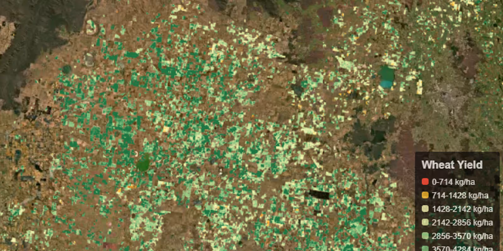
Satellite imagery analytics have been instrumental in a variety of sectors. For instance, in agriculture, SatYield use satellite data to help farmers, traders and insurers to monitor crop yield and productions, optimize practices, and manage resources more efficiently.
The integration of AI and machine learning in satellite imagery analytics has revolutionized the agriculture space, enabling predictive modeling and detailed crop detection for applications ranging from crop mapping, yield prediction, crop loss assessments and more, turning images into valuable insights across various industries.
Satellite imagery analytics, while transformative, are not without limitations. One significant challenge is the time delay in data acquisition and processing, satellites cannot provide real-time monitoring and require time to collect and process data. Additionally, the resolution of images can be limited by factors such as satellite altitude and sensor capabilities, which may affect the detail and usefulness of the data for certain applications.
The expertise required to interpret and utilize satellite data effectively is another barrier, as specialized knowledge is necessary to convert raw data into actionable insights. Furthermore, the availability of historical data is relatively recent, with high-resolution commercial imagery from the last 5-8 years.
Lastly, environmental factors like (space) weather conditions can impact the quality and frequency of satellite captures, posing additional challenges for consistent data collection.
How Satellite Imagery Analytics Platforms Work
Satellite imagery analytics platforms operate by collecting data from satellites that continuously orbit the Earth. These satellites are equipped with sensors that capture images across various spectral bands, beyond what the human eye can see. This data is then processed using computer vision and ML algorithms to extract valuable information about the crops biomass, soil moisture, carbon levels, and more.
Key Features of Satellite Imagery Analytics for Agriculture businesses
Who Benefits from Satellite Imagery Analytics
The Role of SatYield in agriculture space
SatYield emerges as a prominent player in this field, offering a data-fusion AI platform that leverages satellite imagery, computer vision, and deep learning to provide real-time data on crop production and potential risks. With 98% prediction accuracy at a county and state scale, SatYield can generate accurate predictions for any major crop types, in any location and climate, up to three months before harvest.
The platform's ability to fuse data from multiple satellites, weather, and soil sources into a crop model simulator, allows for the calculation of vegetation metrics and identification of yield gaps, variability, and optimization opportunities. This level of precision and foresight is invaluable for stakeholders across the agricultural spectrum, from farmers seeking to maximize their output to policymakers aiming to secure the food supply chain.
more from the blog
