Market Analysis
What a great example of how innovation can be a catalyst for novel solutions. Crop Yield Estimation
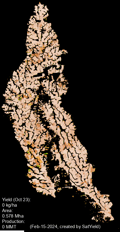
SatYield AI-based Crop Mapping & Yield Estimation, with 98% accuracy, a data-fusion AI platform that leverages satellite imagery, computer vision and deep learning to provide real-time data on crops yield and potential risks, in any Climate, any Geography, without boots on the ground.
In the photo below: a time laps from Planting to Harvesting Soybean, 2023-2024 season, Sorriso, State of Mato Grosso. Over 1.4 million acres of soybean field, with 2.1 MMT of soybean production.
more from the blog
