Overview
Agricultural insurers manage risk across thousands of farms, fields, and growing conditions.
Yet much of the information used to assess crop risk still comes from historical yield records, producer reporting, weather data, periodic field inspections, and assessments performed after a loss has already occurred.
This creates a fundamental visibility gap.
Between planting and harvest, crop conditions continuously change. Drought, excessive moisture, heat, delayed development, poor establishment, and other events can materially affect expected yield long before the impact is visible through traditional assessment processes.
The opportunity is to move from periodic assessment to continuous, independent crop intelligence.
The Challenge
Agricultural insurers face four structural limitations:
- Limited In-Season Visibility
Crop exposure changes throughout the growing season, but insurers often lack a consistent, field-level view of how insured crops are actually developing. - Reactive Loss Assessment
Traditional workflows are frequently designed to determine what happened after a claim or adverse event, rather than continuously identifying where production risk is developing. - Expensive Field-Level Assessment
Field inspections and loss adjustment provide valuable ground truth but are difficult and costly to scale across large geographic portfolios. - Inconsistent Risk Measurement
Weather, historical yields, producer information, and field observations provide different views of risk. Combining them into a consistent and frequently updated measure of expected production remains difficult.
Result: Insurers can carry significant crop exposure without continuously knowing how expected production is changing across the portfolio.
The Solution
SatYield introduces an independent crop intelligence layer across the insurance lifecycle.
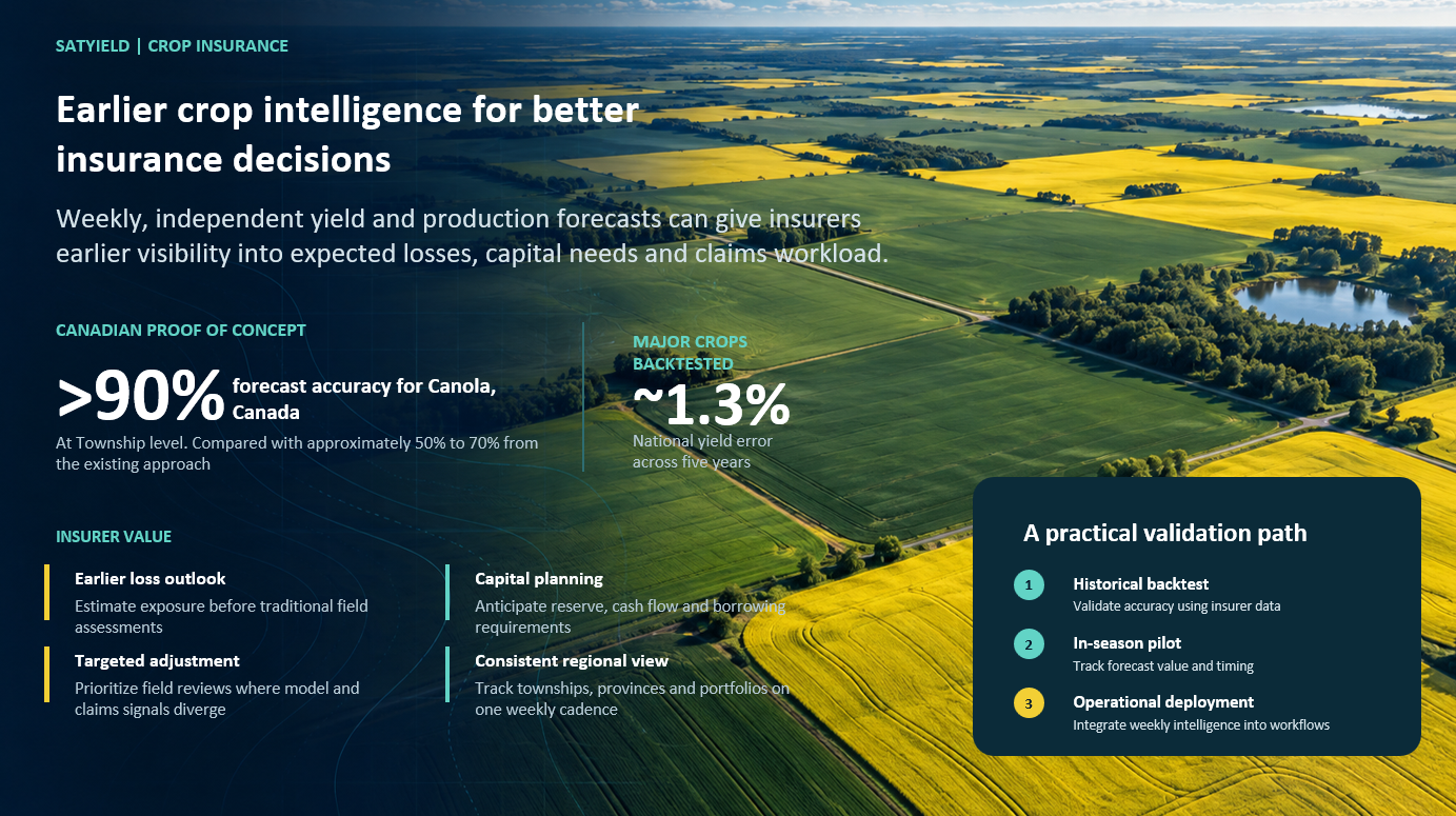
Using satellite observations, weather, soil information, and biophysical crop models, SatYield continuously measures crop development and expected yield from field to portfolio scale.
1. Continuous Crop Monitoring
- Detect and classify crops across insured areas
- Track crop development and phenological progression throughout the season
- Monitor vegetation, biomass, canopy development, and environmental conditions
- Compare observed crop development against expected seasonal trajectories
2. In-Season Yield Intelligence
- Generate frequently updated yield estimates during the growing season
- Measure how expected yield changes as the crop develops
- Identify geographic divergence within an insured portfolio
- Aggregate field-level intelligence to township, county, regional, or portfolio level
3. Early Risk and Anomaly Detection
- Identify areas where crop development deviates from expected conditions
- Detect emerging production risk associated with weather and crop stress
- Prioritize geographic areas requiring additional investigation
- Provide an independent data layer alongside weather, producer, and adjuster information
4. Yield and Loss Assessment Support
- Compare observed production potential with historical and expected performance
- Quantify geographic patterns of yield deterioration
- Support loss investigation with consistent satellite-derived evidence
- Maintain a time series of crop development before, during, and after adverse events
5. Portfolio-Level Risk Intelligence
- Monitor thousands of fields through one consistent methodology
- Aggregate exposure and expected production across crops and geographies
- Identify concentrations of deteriorating crop conditions
- Integrate structured intelligence into underwriting, actuarial, claims, and portfolio systems
Outcomes & ROI
- Earlier Visibility Into Emerging Loss
Identify deteriorating crop conditions during the season instead of waiting until harvest or claim submission to understand the potential impact. - More Targeted Field Assessment
Use satellite intelligence to identify where field inspections and adjuster attention may be most valuable. - Consistent Portfolio Monitoring
Apply the same observation and modeling framework across large geographic portfolios instead of relying solely on fragmented local assessments. - Better Risk Selection and Underwriting Intelligence
Build historical and current crop-performance intelligence that can complement traditional underwriting information. - Stronger Claims Intelligence
Provide an independent, time-stamped record of crop development and changing production potential to support claims investigation and loss assessment. - Scalable Agricultural Risk Management
Expand crop monitoring without requiring field assessment resources to increase proportionally with acreage.
Summary / Conclusion
Agricultural insurance is moving from periodic observation toward continuous risk intelligence.
SatYield transforms satellite imagery, weather, soil data, and crop science into an independent view of how insured crops are actually developing throughout the season.
For agricultural insurers, this means:
- From periodic assessment → to continuous crop monitoring
- From reacting to losses → to identifying emerging production risk
- From fragmented observations → to consistent portfolio intelligence
- From field-by-field visibility → to scalable risk monitoring
The result: a continuously updated yield and loss intelligence layer for modern agricultural risk management.